Eightmile Old-Growth Forest Incineration With Glee
America’s Let It Burn laboratory, the Boise National Forest, is on fire once again. Surprise, surprise.
The Eightmile Foofurb* Fire [here] is over 600 acres and headed for Montana.
*foofurb: euphemism for “fire used for resource benefit.” However, as is usual with foofurbs, no benefits have been elucidated, no EIS created, no NEPA process undertaken or envisioned [here].
The Boise NF is famous for Let It Burn, or should we say infamous. The USFS announced in 2006 that they intended to burn Idaho severely, and then in the middle of the 2007 fire season they declared Idaho forests to be national “Let It Burn Laboratories.” And Let It Burn they did! Over 2 million acres in Idaho were burned deliberately in this fashion by the USFS, including 1,250 square miles of the erosion-sensitive Idaho Batholith in the Payette, Boise, and Nez Perce National Forests [here].
With only 60 percent of the average fire starts, 2007 should have been a mild fire year. However, due to a national policy of Let It Burn, numerous small fires were allowed (encouraged) to become megafires. Approximately 9.75 million acres were roasted nationally in 2007, second only to 2006 (9.89 million acres) since the 1950’s(before cooperative fire protection was fully implemented).
Let It Burn is particularly popular in Idaho, where the National Interagency Fire Center is located (in Boise, where else?). Fire guys like fires. It’s their bread and butter, They see forests as piles of fuel — opportunity knocking, in other words — double-overtime hazard pay when those forest fuel piles are torching away. Hence the Boise NF is one of NIFC’s pet incineration projects, for which they feel the same sort of affection that jet fighter pilots feel for a bombing range.
The Eightmile Fire was ignited July 12 along the West Fork of Eightmile Creek, roughly 4 miles north of ID State Route 12. The Boise NF reported that the Eightmile Fire was within the Lowman Burn (1989), but that was an untruth and they knew it.
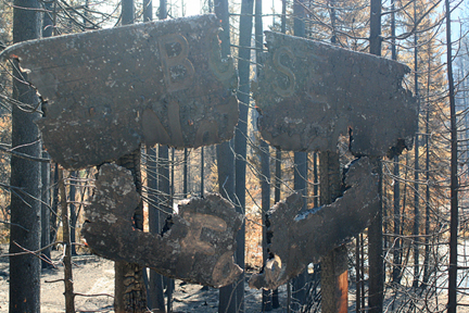
The Lowman Fire was a megafire that roasted 47,000 acres and burned up most of Lowman, a small mountain town formerly known as “The Gateway to Ponderosa Pine Scenic Route” (Rte. 21). The scenic pines are charred snags now.
The Boise NF, InciWeb [here], and even R. Barker of the Idaho Statesman [here] all reported the Eightmile Fire as within the Lowman Burn. That counter-factual is dispelled on the following map:

Why all these government media outlets chose to lie about the location of the Eightmile Fire is a matter of conjecture. Motives for lying are sometimes difficult to discern, and sheer incompetence cannot be ruled out. R Barker provides the following statements which might be revealing:
When the dozens of lightning strikes hit the tinder of the Lowman forest in 1989 the traditional stands of 60 large trees per acre had grown into thickets of 1,500 trees per acre. It all turned into ashes.
The appearance of the Lowman blaze area feeds the still polarized debate over the role of fire. You have to look close to see the five to 10 foot tall ponderosa pines that rise out the thick brush.
The U.S. Forest Service planted 10 million trees on 31,000 of the 47,000 acres that burned. In a sense the agency got a chance to start all over.
But to do that meant it would have to restore the historic frequency of fire.
In the area around Lowman it thinned the forest mechanically. There and in other areas the Forest Service has set fires during the spring and late fall so it allows the blazes on its own terms.
When the predictable lightning storm ignited a fire in the Eightmile Basin within the Lowman fire area July 12, the agency decided to watch it, not fight it.
From this we can conclude the following:
1. Lack of appropriate forest management led to overstocked thickets of young pine that were choking the life out of the older cohort pines, remnants from the frequent fire (anthropogenic fire) era prior to elimination of the Native American residents and their tradition ecological practices (something the USFS and R. Barker are mostly clueless about).
2. Fire in pine thickets kill young-growth and old-growth trees alike, leaving a wasteland of snags and ashes.
3. Thick brush sprouts back quickly following catastrophic (stand-replacing) fires, so that within 10 to 20 years the fine fuels are back with a vengeance, restoring the fire hazard to extreme conditions.
4. In some areas the USFS has thinned the thickets and under-burned with care to restore heritage open, park-like forest conditions. Very little restoration forestry has occurred, however, primarily because of a firestorm of lawsuits from so-called “environmental” groups who desire catastrophic fire and wasteland conditions rather than healthy, restored forests.
5. So rather than pushing forest restoration, the Boise NF prefers catastrophic fires that lay waste to the old-growth forests and convert them to fire-type brush. That works for the USFS because the fire guys have taken over the agency and they like the megafire megabucks, and it has been easier to give in to the holocaust-minded so-called “environmentalists” than to fight for decent stewardship of our public lands.
So when the Eightmile Fire ignited, it was more profitable (for some) and just easier to lie about its location than to admit the fact that fresh and new forest devastation and old-growth conversion to tick brush was taking place.
It was just a little white lie, told by little white people who have little regard for the truth when it doesn’t suit their long term goals of milking the U.S. Treasury and roasting all the old-growth they can. So what if the lie is also a-scientific and a-historical to the point of barking racism? We should not expect any better than that from the little white people who serve (or dis-serve, as the case might be) the public.
And now the Eightmile Foofurb Fire has blown up, crested the ridge, and burned down into the East Fork of Eightmile Creek, and run up slope toward the Red Mountain Lakes area, one the premier backpacking spots in Idaho, killing old-growth all the way and leaving a wasteland behind.
Meanwhile the residents downwind of the fire are choking in the smoke as they prepare to evacuate when the firestorm arrives.
The individual most directly responsible for all this is Cecilia Seesholtz, Boise Forest Supervisor. She may be contacted at 1249 S. Vinnell Way, Suite 200, Boise, ID 83709, (208) 373-4100.
Soon the Palousers [here] will arrive, the perennial August winds that sweep off Eastern Washington into Idaho. When the winds whip up to gale force, the Eightmile Foofurb Fire will erupt into a firestorm that will burn through the Sawtooth Mountains. If the Palousers blow due east, Stanley, Sunbeam, and Clayton will be in the fire’s path. If the winds are more northerly, Ketchum could be the target. If more southerly, the fire may not be stopped until it reaches Montana.
The so-called “environmentalists” will be ecstatic. Maybe Cecilia will win an award, the “Most Forest Devastated by Deliberate Holocaust” prize. Already the fire bugs in Boise are rubbing their claws with glee.

Good! You have to worry when the forest can’t even locate the fire correctly on a map.
You would be amazed at how pitiful the Forest Service is at using maps and compass. The “ologists” rely too much on GPS units and many timber folks carry a compass but don’t know how to use it well. I had designed an exercise to see just how much our people knew about maps and compasses, just to draw out those who pretend to know this basic skill. Alas, we didn’t have the time to get everyone to do it.
Having spent 2 years on the Boise, I know that the terrain there is pretty extreme. Firefighters never did put out the 1994 Rabbit Creek Fire. Fall snow and the majestic Sawtooths stopped the 200,000 acre fire. Amazingly enough, we were salvaging timber less than one year after the fire went out. And that was even after a successful defense in court! The Lowman RD has seen its share of mega-fires in the recent past. The ground is steep and the vegetation is thicker than on the southern portion of the forest.
Maybe the Forest Service is getting the message that the Let-Burn program has failed and that their asses are hanging out of their “green shorts”.
by YPmule
Fortunately the season ending event came a month or two early on this fire - lets hope the hot spots don’t flare back up after the crews leave.

Rumor has it that the public protest over the Eightmile Foofurb Fire has spurred the Boise NF into some sort of action.
Apparently (not confirmed officially) as of Monday morning fire crews are engaged in direct attack on the east side of the Eightmile Fire. They are attempting to stop the fire on the ridge and not let it get further down into the East Fork. The plan is to line the fire downstream of Castro Fork and not let it burn the Red Mtn Lakes area or the Kirkham Ridge Trail.
Two helicopters are bucketing water. They’ve already spent much more than it would have cost to put it out in the first place when it was just a single tree aflame.
Boise NF officials have scheduled a community meeting at the Lowman fire station on Wednesday at 6 pm, although that has not been formally announced as yet. None of the above has been formally announced. You heard it here first.