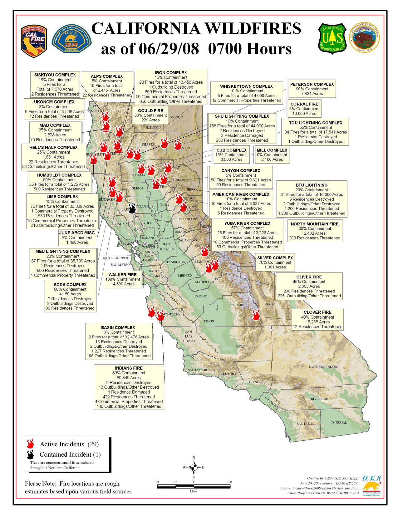
CA Fire Map Sunday 06/29 AM
Click map for larger image (1.1 MB).
RED FLAG WARNING in effect from 1 pm this afternoon to 5 am PDT Monday for Northeast California including E Shasta Co., Burney Basin, W. slope Sierra Nevada including Plumas NF; Southern and Central Oregon; and Northern and Central Nevada for scattered dry thunderstorms. Many storms today will produce little to no rainfall due to dry air above the surface. By Sunday more storms will become wetter but shorter rainfall duration is expected due to increased storm motion.
California Summary 06/29/08
Total Fires: 1,420
Total Acres Burned: 356,134 (556 sq mi)
Resources Committed
Personnel Committed: 18,608
Fire Engines: 1,377
Hand Crews: 465
Dozers: 331
Water Tenders: 375
Helicopters: 92
(These numbers are totals from state, local and federal firefighting agencies. Updated 6/28 at 9:00 p.m.)
Highway closures: State highways and local roads are closed throughout California due to wildfire activities. Closures and delays are in place for State Highways 1 (Big Sur Area), 32, 36, 70, 96, and 151. Numerous county and local roads are closed as well. Travelers are advised to seek current information from local law enforcement.
Evacuations: Areas of Butte, Monterey, and Shasta counties are under evacuation orders at this time. Precautionary evacuation orders are in place for areas in Butte, Lassen, Mariposa, Mendocino, Shasta and Tehama counties. Residents are advised to monitor the fire situation in their areas, check with local law enforcement agencies for information, and be prepared to evacuate when necessary.
Structures Threatened: 7,589 residences, 135 commercial, 2,856 outbuildings. Structures Destroyed: 29 residences, 1 commercial, 21 outbuildings.
