CA Fire Map Monday 06/30 AM
Click map for larger image (3.5 MB).
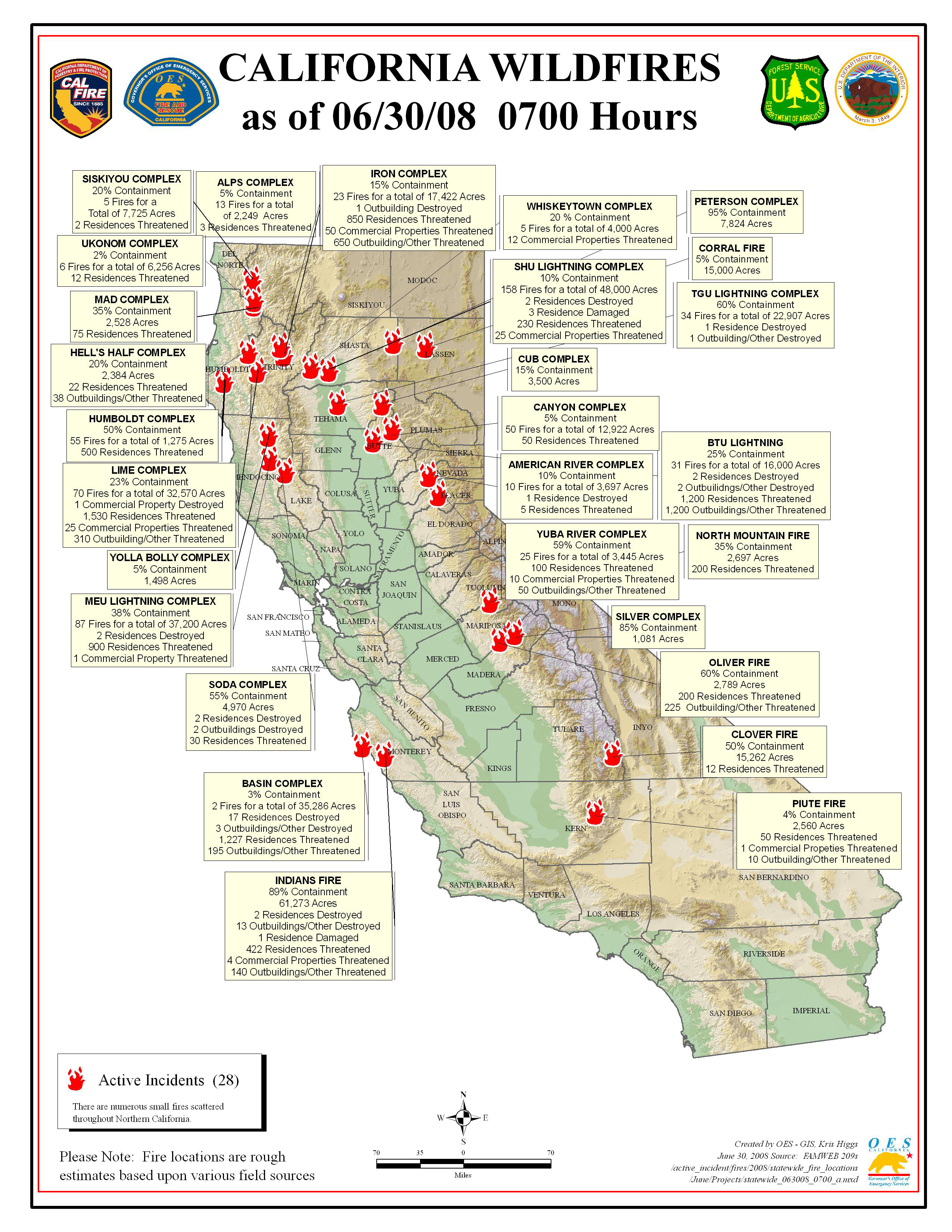
California Summary 06/30/08
Total Fires: 1,459
Total Acres Burned: 379,115
These numbers are total fires and acres that have occured from state, local and federal firefighting agencies beginning June 20, 2008.)
Resources Committed
Personnel Committed: 19,240
Fire Engines: 1,429
Hand Crews: 491
Dozers: 365
Water Tenders: 413
Helicopters: 94
(Updated 6/30 at 9:00 a.m.)
Highway closures: State highways and local roads are closed throughout California due to wildfire activities. Closures and delays are in place for State Highways 1 (Big Sur Area), 36, 70 and 96 (delays). Numerous county and local roads are closed as well. Travelers are advised to seek current information from local law enforcement.
Evacuations: Areas of Butte and Shasta counties are under evacuation orders at this time. Precautionary evacuation orders are in place for areas in Butte, Kern, Mariposa, Mendocino, Shasta and Trinity counties. Residents are advised to monitor the fire situation in their areas, check with local law enforcement agencies for information, and be prepared to evacuate when necessary.
Structures Threatened: 7,672 residences, 136 commercial, 2,851 outbuildings.
Structures Destroyed: 30 residences, 1 commercial, 20 outbuildings.
