Ancient Earthmovers Of the Amazon
Charles C. Mann. 2008. Ancient Earthmovers Of the Amazon. Science, Vol 321, 29 August 2008, pp 1148-1152
Full text [here]
Much of the environmental movement is animated, consciously or not, by what geographer William Denevan calls “the pristine myth”—the belief that the Americas in 1491 were an almost untouched, even Edenic land, “untrammeled by man,” in the words of the Wilderness Act of 1964, a U.S. law that is one of the founding documents of the global environmental movement. - Charles C. Mann, 1491: New Revelations of the Americas Before Columbus.
The most “pristine” wilderness in the America’s is widely thought to be the Amazon. But in fact the Amazon has been home to humanity and human civilization for thousands of years. New anthropological and landscape geography research has turned up yet another “lost” civilization in the supposedly untrammeled Amazon, further proof that our landscapes hold ancient human tradition and use, the legacy impacts of which may still be seen today.
Wilderness is indeed a myth, a modern Euro-American construct that lacks veracity and validity in the real world. Before we impose more political myth on our landscapes, wouldn’t it be prudent and responsible to see and study them for what they are, ancient homelands and settings of human stewardship, not abandonment?
Selected excerpts:
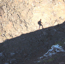
The forested western Amazon was once thought barren of complex human culture. But researchers are now uncovering enigmatic earthworks left by large, organized societies that once lived and farmed here.
Alceu Ranzi was a geography student in 1977 when he helped discover half a dozen huge, prehistoric rings carved into the landscape in his home state of Acre in western Brazil. At the time, he was helping to conduct the first-ever full archaeological survey of Amazonia, which was being opened up for cattle ranches at a speed that was causing worldwide protests. The earthworks came to light on newly logged land.
The find attracted little attention. The Smithsonian-sponsored National Program of Archaeological Research in the Amazon Basin did not formally announce the rings for 11 years, and even then only in a little-read report. And Ranzi, who went on to become a respected paleontologist, most recently at the Federal University of Acre in Rio Branco, didn’t get back to studying the ditches until more than a decade after that. On a flight to Rio Branco in 1999, he spotted the earthworks again from the air and soon began looking for more. Within a year, he says, “we had found dozens more” of what he calls geoglyphs.
Shaped like circles, diamonds, hexagons, and interlocking rectangles, the geoglyphs are 100 to 350 meters in diameter and outlined by trenches 1 to 7 meters deep. Many are approached by broad earthen avenues, some of them 50 meters wide and up to a kilometer long. The geoglyphs “are as important as the Nazca lines,” Ranzi says, referring to the famed, mysterious figures outlined in stone on the Peruvian coast. …
For most of the last century, researchers believed that the western Amazon’s harsh conditions, poor soils, and relative lack of protein (in the form of land mammals) precluded the development of large, sophisticated societies. According to the conventional view, the small native groups that eked out a living in the region were concentrated around the seasonally flooded river valleys, which had better soil; the few exceptions were short-lived extensions of Andean societies. Meanwhile, the upland and headwaters areas-which include nearly all of western Amazonia-had been almost empty of
humankind and its works.Yet during the past 2 decades, archaeologists, geographers, soil scientists, geneticists, and ecologists have accumulated evidence that, as the geoglyphs team puts it, the western Amazon was inhabited “for hundreds of years” by “sizable, regionally organized populations”-in both the valleys and the uplands. The geoglyphs, the most recent and dramatic discovery, seem to extend across an area of about 1000 kilometers (km) from the Brazilian states of Acre and Rondônia in the north to the Bolivian departments of Pando and the Beni in the south (see map, p.1150). Much of this area is also covered by other, older forms of earthworks that seemingly date as far back as 2500 B.C.E.: raised fields, channel-like canals, tall settlement mounds, fish weirs, circular pools, and long, raised causeways (Science, 4 February 2000, p. 786), suggesting the presence of several cultures over a long period. And on page 1214 of this issue of Science, a U.S.-Brazilian team proposes that indigenous people in the south-central Amazon, 1400 km from Acre, lived in dense settlements in a form of early urbanism and created ditches and earthen walls that some say resemble the geoglyphs (see sidebar).
Researchers are still puzzling over whether and how these earthworks fit together and what they reveal about the people who created them. But already the implications of these enormous endeavors are clear, says Clark Erickson, a University of Pennsylvania researcher who has been working in the area with Bolivian colleagues since 1995. Far from being trapped by the Amazon’s ecological obstacles, he says, these large populations systematically transformed the landscapes around them. One example: Because geoglyphs cannot readily be constructed or even seen in wooded areas, the researchers argue that people must have made them at a time when the region had little tree cover-meaning that in the not-too-distant past the great forests of the western Amazon may have been considerably smaller.
Not only did the peoples of western Amazon alter their environments, but they also transformed the biota in them. Emerging evidence suggests that this little-known region may have been a place where longago farmers first bred some of the world’s most important crops. In Erickson’s view, western Amazonia serves as a model of how human beings create and maintain productive landscapes from even the most apparently limited environments.
The new findings show that the region was “a cosmopolitan crossroads” between the societies of the eastern Amazon and the Andes, of whom the most famous were the Inka, says Susanna Hecht, a geographer at the University of California, Los Angeles: “You have every language group in lowland South America represented there.” She adds, “It was a major cultural center-and it’s incredible that this is just coming out.” …
Looking smarter, in Erickson’s view, means going beyond archaeology’s traditional focus on the individual site to entire landscapes. “What Amazonian peoples did in constructing/building environments was more visible and permanent at a regional scale than at the site scale,” he argues. To study at this scale, archaeologists are adopting adopting new methods, from soil chemistry to network theory. …
Living on this artificial inland archipelago, Amazonian peoples ate a diet heavy in fish, which migrate and spawn in the flooded savannas. Today, as Erickson discovered in 2000, networks of earthen fish weirs still crisscross a 500-square-kilometer area in the grassland. These low, interconnected berms change direction, zigzag-style, every 10 to 30 meters. At the angles are funnel-like openings for nets or traps. Built as early as the 13th century, they fell into disuse only in the 18th century. “Think of it as aquaculture,” Erickson says. “The weirs allowed people to manage and harvest the catch.” When the waters receded, the area’s early inhabitants ensured that they drained into hundreds of artificial fish ponds. Typically about 30 meters across, they are often full of fish today.
Agriculture was just as intensive. In a broad, 50,000-square-kilometer swath of savanna around the mounds, the Beni’s indigenous peoples built raised fields-artificial platforms of soil that lift crops above the floodwaters, according to research by geographer William Denevan, a professor emeritus at the University of Wisconsin, Madison, who in 1963 was one of the first to call attention to them. Like raised beds in temperate-zone gardens, the mounds promote drainage and increase the amount of topsoil. From the few carbon dates available, Erickson says, “we see raised fields coming in and out of production from 3000 B.P. to 500 B.P.-or until roughly the time the conquistadors arrived, bringing diseases that wiped out much of the native population. …
Strikingly, one of the Amazon’s most important agricultural innovations may have originated soon after the breeding of modern manioc and peach palm. Known as terra preta, it consists of patches of soil ranging from less than 1 hectare to several hectares that have been modified by adding huge quantities of crumbled charcoal (Science, 9 August 2002, p. 920). An informal Brazil-Germany-U.S. collaboration has been investigating this artificial soil, which maintains its fertility for long periods despite the harsh tropical conditions. Earlier this year, five researchers led by Christoph Steiner of the University of Bayreuth in Germany reported that adding charcoal and soot to weathered Amazonian soils caused a “sharp increase” in microbial activity: Soils damaged by exposure became, so to speak, more alive. …
Terra preta is believed to have been an essential part of a distinctive agricultural system. According to the terra preta team, Indians slowly cleared off the forest to create farm plots and planted annual crops such as manioc and peanut. In the past, researchers argued that as the exposed soil lost its fertility, farmers shifted to other areas in a pattern called “slash and burn.” But researchers now suggest that Indians instead took steps to retain soil fertility by creating terra preta. According to studies by Wisconsin’s Denevan, removing trees with stone axes was so difficult that the logical path for native peoples would not have been to clear additional forest every few years but to replant the enriched fallow earth with tree species useful to humankind—rotating annual and tree crops over time.
The oldest terra preta patches yet known, carbon-dated to about 2500 B.C.E., are in Rondônia, not far from the Brazil-Bolivia border, suggesting to Eduardo Goes Neves of the University of São Paolo that these techniques may have been invented there. In surveys this year and last, Neves discovered “terra preta almost everywhere we looked.” Pärssinen, though, says that the geoglyphs team has not yet found big patches of terra preta in Acre. “How these large groups supported themselves there without it is a mystery,” he says.
If the rest of the Rondônia terra preta is as old as the dated patches, Neves says, “we’re looking at a huge jigsaw puzzle” of an ancient culture—or cultures. As he sees it, “in the west and southwest, there’s the mounds and canals, there’s the development of manioc and peach palm, there’s the fish weirs that Clark [Erickson] found—and we don’t know how any of it fits together. On top of that, there’s the geoglyphs all over the place.” …
Researchers think it likely that the geoglyphs extend continuously between Acre and the Beni; Pärssinen notes the recent discovery of large geoglyphs near the city of Riberalta, on the northernmost tip of the Beni. But they cannot be sure, because between Riberalta and Rio Branco, in Acre, is about 150 km of the mostly forested department of Pando. “It seems unlikely there is no connection, but any connection is not yet proven,” Schaan says.
Nor is it known whether the geoglyphs served any practical function. Most of the Acre geoglyphs are on higher ground, making them of little use for drainage. Many have outer walls that look down on the central area, suggesting that they were not used for defense. To be sure, one of Walker’s earthworks was connected to a river “by a deep channel and had a connection to a swamp on the other side,” he says. “It could have been used to control water flow off of the savanna in the dry season. So at least some of these earthworks could have had a hydraulic function.” Many, though, are almost entirely without other traces of human presence, such as ceramics. “The immediate response is that they were symbolic places,” says Stahl. “But that’s the old archaeological canard: If you can’t figure out the function of something, you say it was for ritual.”
The late arrival and ubiquity of the geoglyphs may indicate that some type of cultural movement swept over earlier social arrangements. “But whatever was there, these societies have been completely forgotten,” says anthropologist Guillermo Rioja, director of sustainable development and indigenous peoples for the Pando. “It’s only been 400 years since they vanished. Why does nobody here know anything about them? They were living here for such a long time, and nobody knows who they were.”
One reason for the lack of attention, in his view, is archaeology’s long focus on Andean societies of Peru and Bolivia, with their grand stone ruins. “The idea is that the tribes in the lowlands were living like animals in the wild,” Rioja says. “When you tell them that there were great, important civilizations here in the western Amazon, they don’t believe it. But it’s true.”