CA Fire Map Thursday 07/24 AM
Click map for larger image
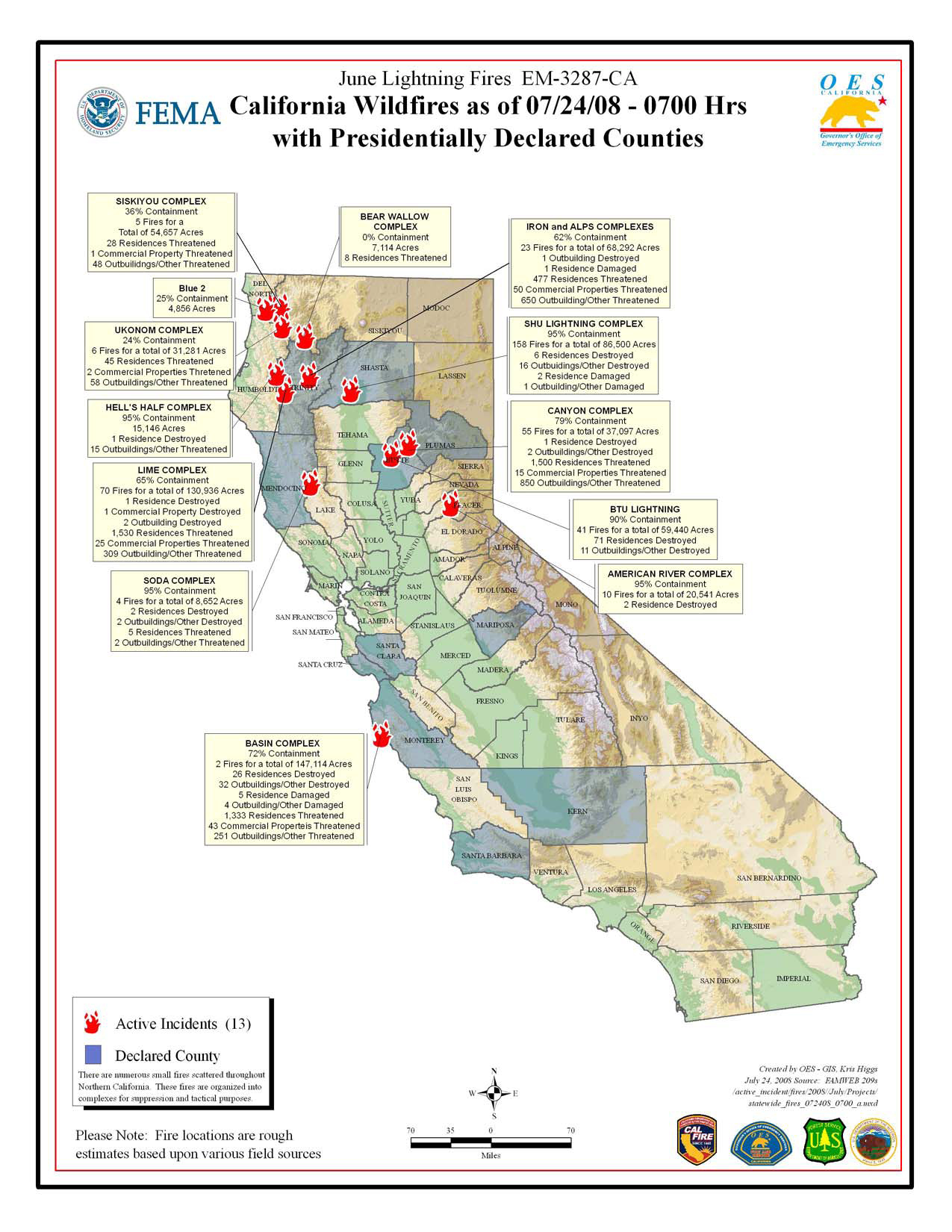
California Summary 07/24/08
Total Fires at Peak: 2,093
Total Fires Contained: 2,062
Total Active Fires: 31
Total Acres Burned: 1,032,722 (1,614 sq miles)
These numbers are total fires and acres that have occurred from state, local and federal firefighting agencies beginning June 20, 2008.
Highway closures: Firefighters remind everyone to use extreme caution while driving on roads affected by fires. All major roads are now open. There may be some delays State Highways 70 and 299. Travelers are advised to seek current information on secondary road closures from local law enforcement. Click here for detailed road closures.
Evacuations: Areas of Shasta, Trinity and Humboldt counties are under evacuation orders at this time. Precautionary evacuation orders currently exist in areas of Monterey, Siskiyou and Trinity counties. Residents are advised to monitor their local fire situation, check with local law enforcement agencies for information, and be prepared to evacuate when necessary.Click here for detailed evacuation information.
Structures Destroyed : 158 residences, 1 commercial, 139 outbuildings.
